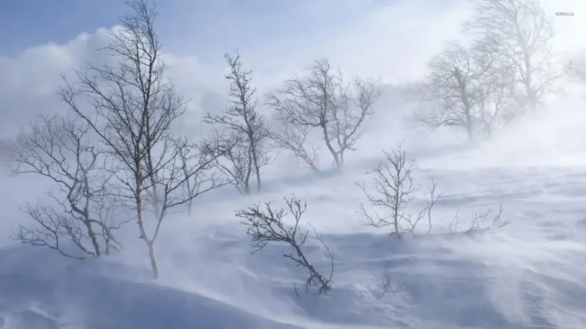
A powerful late-season winter storm is expected to hit the Sierra Nevada region on May 1, 2026, bringing unprecedented snowfall and dangerous driving conditions. With forecasts predicting up to 4 feet of snow and wind gusts reaching as high as 70 MPH, travelers should prepare for significant disruptions.
Just days prior, many were enjoying mild weather—spring had finally seemed to settle in. Hikers were out on the trails, and families were planning weekend getaways. But then, the forecast shifted dramatically. The National Weather Service issued warnings about the impending storm, noting that snow levels would drop from 7,000 feet to as low as 4,500 feet.
As the storm approaches, officials are already anticipating major impacts on travel. Chain control will likely be enforced for most vehicles at elevations above 5,000 feet. Roads like I-80 and Highway 50 could face multi-hour closures starting Sunday night into Monday.
Key statistics:
- Expected snow totals: up to 4 feet
- Wind gusts: 50-70 MPH along the Sierra crest
- Chain requirements: likely for vehicles above 5,000 feet
Drivers are advised to heed winter driving tips—clear snow and ice from their vehicles before hitting the road. The cleanup process won’t be easy; temperatures are expected to remain below freezing for much of the week, limiting any chance of snow melt.
Local weather expert noted, “If you have to travel, watch out for these specific mountain passes: I-80 (Donner Pass): Very high risk.” As communities brace for this unusual spring storm, it’s clear that safety must come first.
The system arrives Sunday evening, peaks on Monday, and tapers off by Tuesday afternoon. With blizzard conditions anticipated, everyone in the area should stay informed and prepared for rapidly changing weather conditions.
David Miller
David covers technology, science, and innovation from around the world.